Day Three (Friday): The Canadian Rockies
For anyone thinking about the cross-country journey on The Canadian, a primary consideration probably has to do with the Canadian Rockies. And that goes together with – hopefully – an opportunity to bring home some images (mental or, if travelling with a talented photographer, nice photographs that will keep the memory of that impressive experience alive for a long time to come. Some of us, though, want to add a few words that will – if we’re lucky – enhance the experience. So I’ll just try to focus here on Andrew’s photos and provide some thought of my own.
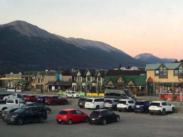
The day started with an early call for anyone looking for a 6.30am breakfast and three hours of walking about in the resort town of Jasper. It’s the location of the Fairmont Jasper Park Lodge, as well as the Jasper Skytram which carries visitors to the summit of one of the mountains (and which we could see from the train later in the morning).
Of course nothing was open when the train stopped, and we had no explanation (and we didn’t care) for why there was such a long wait at Jasper. But there were several such “slow-downs” (we might call them) during the journey, so they probably had something to do with the overall management of the train. Or perhaps they’re built in to the schedule (my theory) to allow time for required delays when the winter weather affects the train’s schedule.
But the reason didn’t matter – we had our three-hour wait in Jasper, and we were able to have a nice glimpse of the town with its charming faux-Alpine buildings. Fortunately the weather wasn’t too chilly, and some of the guests on the train could have a nice walkabout and then go back to bed or just sit and engage in conversation with others in the observation car or in the lounge outside the dining car. For some of the train’s guests (like us), the delay was just an opportunity to sleep late, since the final breakfast call was at 9am and no one really cared whether you were walking about or sleeping in.
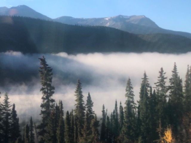
Once we got higher into the Canadian Rockies, it became evident that we were going to get to see some very exciting sights. One of the most unusual (for us) was how often the fog (clouds hanging low?) got down below the mountain tops without obscuring the peaks. As a boy growing up in Southwestern Virginia, I had often seen mist on ponds and lakes near where we lived, in the Blue Ridge mountains, but I had never seen anything like this. I suppose it was just another of those “different” weather phenomena we have in different locations.
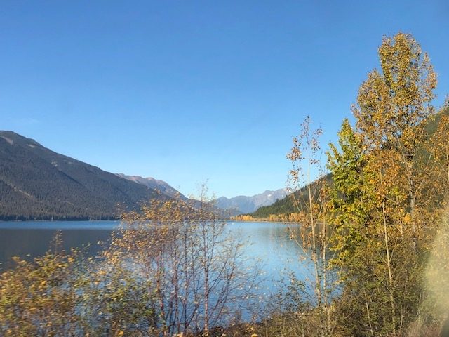
Another new experience (and something new to learn) was to see in the Canadian Rockies the sources of some of the larger rivers found in North America. One we enjoyed finding out about was the Fraser River, the longest river within British Columbia. It begins at Fraser Pass and flows 854 miles into the Straight of Georgia just south of Vancouver. Named for Simon Fraser, who led an expedition in 1808 on behalf of the North West Company from the site of present-day Prince George almost to the mouth of the river. Another explorer (George Simpson in 1828) determined that the Fraser River was non-navigable (“I should consider the passage down to be certain Death, in nine attempts out of Ten. I shall therefore no longer talk about it as a navigable stream.”) Though not navigable for we mere mortals, it is one of the major salmon runs of the Pacific Northwest.
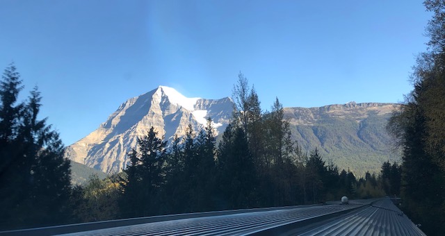
Another spectacular site in the Canadian Rockies is Mount Robson, possibly named – oddly enough – for Colin Robertson, who worked for both the North West Company and the Hudson’s Bay Company at various times in the early 19th century. But the name is also attributed to John Robson, an early premier of British Columbia. But no matter who the mountain is named for, there is no question about it as a spectacular sight. It is recognized as the most prominent mountain in all of North America’s Rocky Mountain range, and it is, accordingly, the highest point in the Canadian Rockies.
Seen above is a photograph taken from the last row of the train’s observation car (with a bit of the train in the picture). It was in viewing this particular mountain that we learned just how lucky our trainload of travelers was. There are only about fourteen days a year – we were told – when the mountain can be observed clearly, with its glacier dramatically blanketing the top of the mountain’s peak. We were seeing Mount Robson (12,972 feet high) on one of those fourteen days.
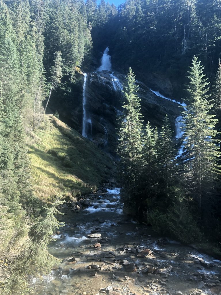
A final spectacle in our Canadian Rockies adventure was possibly one of the most beautiful things we saw. Pyramid Creek Falls in British Columbia (commonly called just Pyramid Falls), is located on the east side of the North Thompson River between the towns of Blue River and Valemont.
For all intents and purposes, Pyramid Falls and the park associated with the falls are inaccessible, not just extremely difficult (we were told). Most visitors are forced to settle for views of the falls from across the river. However (and again making us feel very lucky), passengers on VIA Rail trains (most notably on The Canadian) are able to get a close-up view of the falls as the train track run past the falls. The approach to the falls is announced by a crew member as the train approaches and the train slows down to a crawl, to allow passengers a better view. And to give us time to take some very special photographs.
I so enjoy the observations and reporting of your Canadian trip!
So familiar, yet different from my trip in 1952…. at that time it was The Union Pacific Rairoad crossing Canada, thru the exhiliarating Rockies. We have much to reminisce.